Mapping

Maps of the UAE for both visitors and residents.
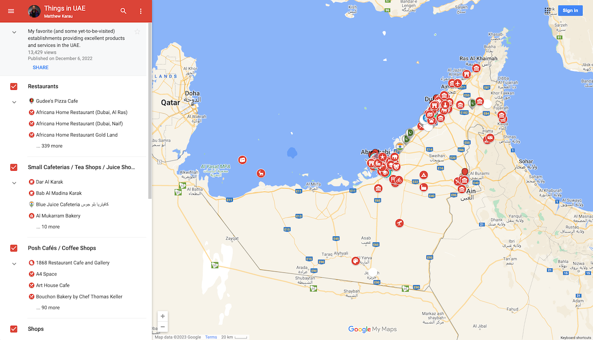 The Things in UAE map, started in 2010, is a collection of places in the UAE that are (or were) interesting parts of the fabric of living in or visiting the UAE. Some are hole-in-the-wall gems; others are obvious tourist attractions, and there has been a concerted effort to fill the gaps between with shops, restaurants, cafes, and experiences that cover the broadest spectrum of experiences in the UAE.
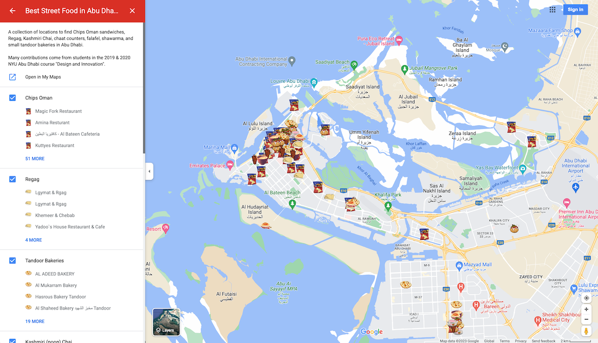 The Best Street Food in Abu Dhabi map, started in 2019, is a collection of places in Abu Dhabi that serve dishes that might be considered street food. As there isn't a "street food" culture in UAE like there is in other countries, the types of restaurants and dishes featured here are those that are "cheap and cheerful" and part of Abu Dhabi's Emergent Culture. The dishes typically originate somewhere else; they are not "from" the UAE, but they are "of" the UAE and are therefore an unmistakeable and undeniable part of the lived experience in the country. The map focuses on Chips Oman Paratha Sandwiches, Regag, Tandoor Bakeries, Kashmiri (noon) Chai, Matka (Tandoori) Chai, Chaat Counters, Biryani, and Koshari.
Abu Dhabi Department of Culture and Tourism Urban Treasures
 The DCT Urban Treasures map is a visualization of the establishments selected as part of the Urban Treasures initiative by the Abu Dhabi Department of Culture and Tourism.
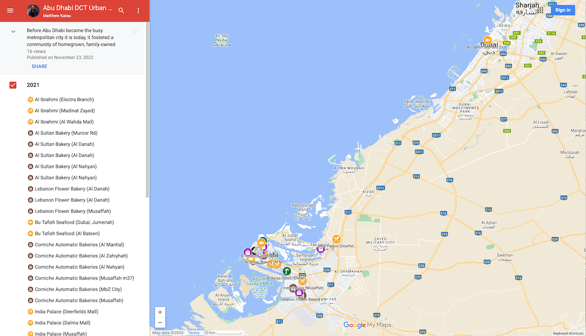
Before Abu Dhabi became the busy metropolitan city it is today, it fostered a community of homegrown, family-owned businesses such as cafés, restaurants, bakeries, sweet shops, textile stores, that were engrained into the social and cultural fabric of the city.
In recognition of their contribution in the last 20 years, Abu Dhabi is honouring these establishments as Urban Treasures, which continue to serve the current and future generations of our modern city.
These longstanding establishments have played a valuable role in shaping the vibrant urban culture of Abu Dhabi and contributing to the city’s economy. Today, these hidden gems are considered historically significant in the collective memory of the local community.
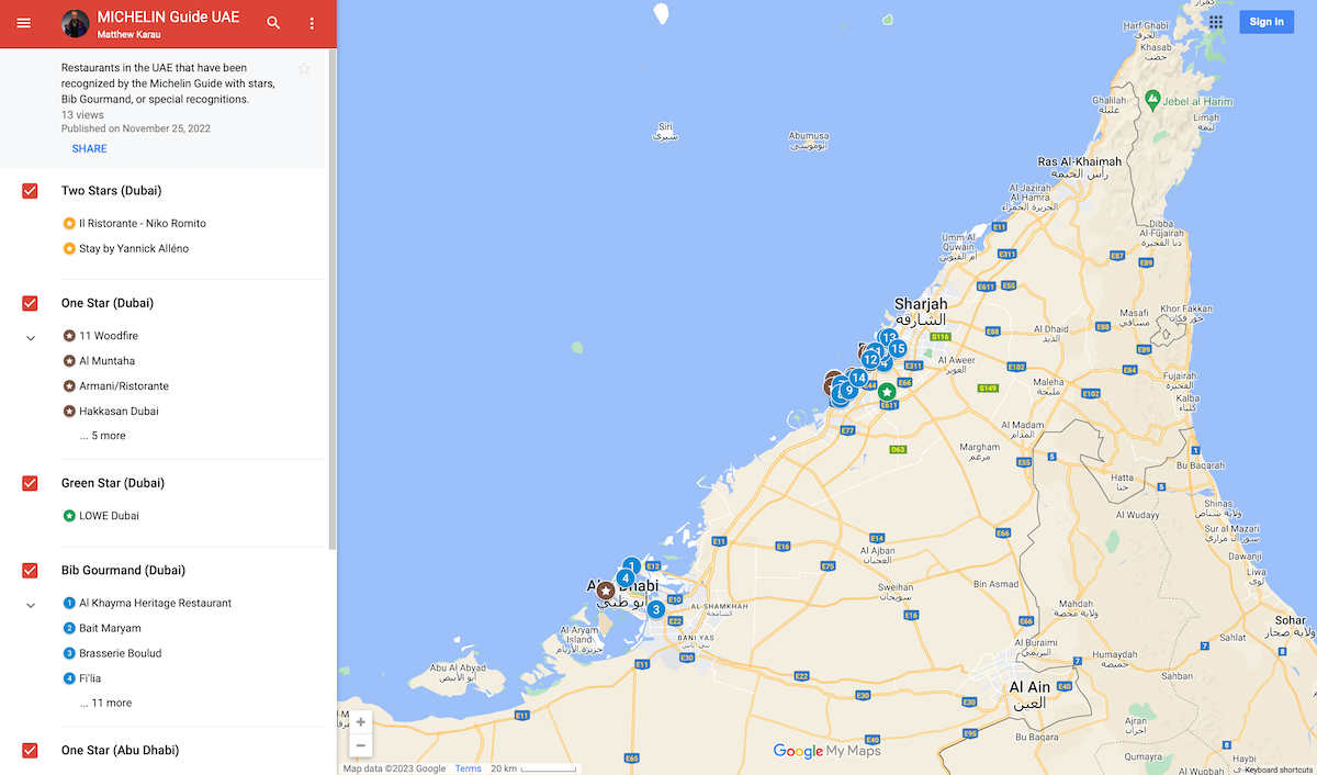 The Michelin Guide UAE map visualizes the restaurants of the UAE that have been recognized by the Michelin Guide with the distinctions of "Bib Gourmand", "1 Star" and "2 Star". The Michelin guide first began reviewing restaurants in Dubai and Abu Dhabi in 2022.
F4Maps: 3D Maps of NYUAD Campus
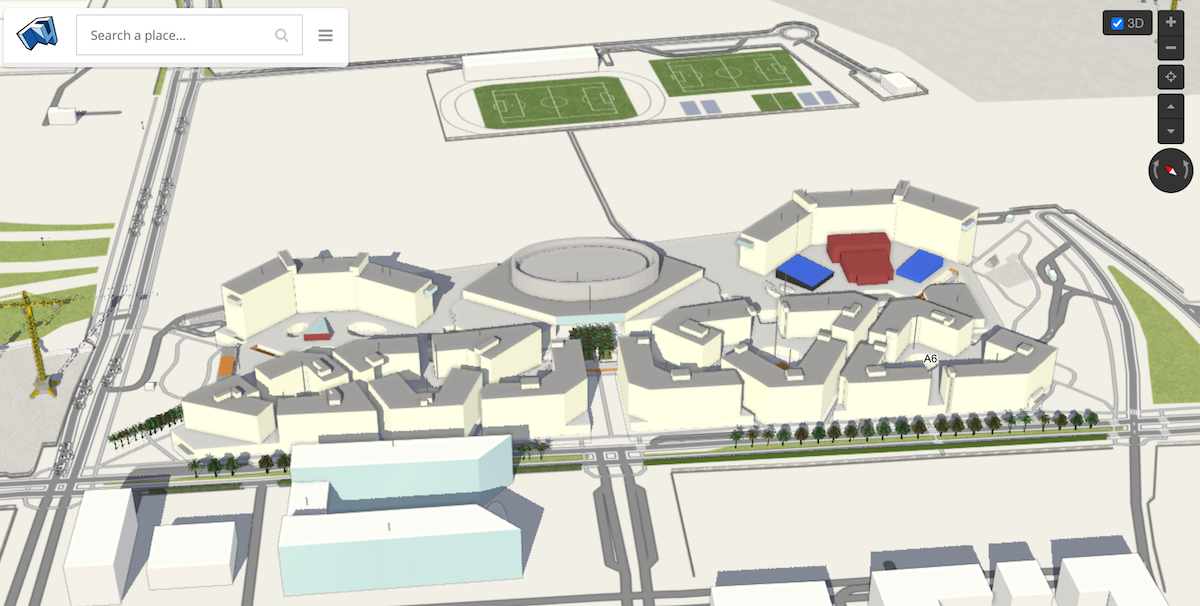 There are a number of online services that use OpenStreetMap data to reconstruct 3D representations of buildings. As early as 2014, Matthew Karau and others began encoding data about the buildings of the NYU Abu Dhabi Saadiyat Island Campus into OpenStreetMap, eventually creating a rudimentary but relatively complete model of the campus. You can view a very high-fidelity rendering of campus using the F4Maps Demo Interface. You can also view the campus in 3D using OSM Buildings or Streets GL. (Note: OSMBuildings seems to block some geographies from using its services, including the UAE, at times). If you're curious about all the ways the OpenStreetMap data can be used in 3D environments, be sure to check out their Wiki Page dedicated to viewing the map in 3D. If you're interested in using the 3D data in other programs, explore using the OSM2World, Blender GIS or blender-osm tools that provide pathways to export data in common 3D interchange formats (OBJ, STL, etc).
OpenBusMap / OPNVKarte: Public Transportation Networks in UAE (Work in Progress)
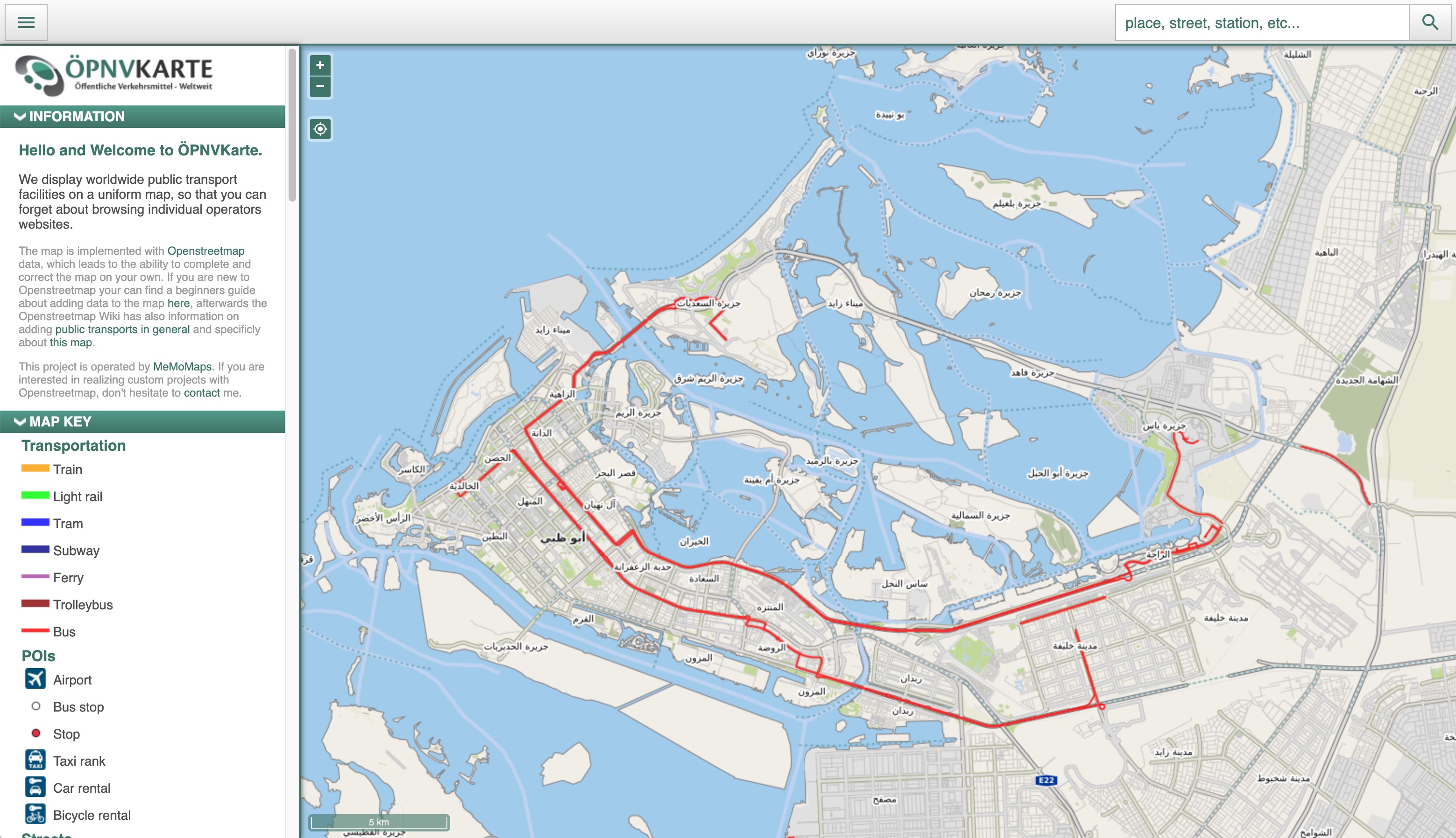 Although public transportation is not, as of 2025, a common mode of conveyance in the UAE, the networks and coverage have slowly grown and become more enticing. Other commercial map providers have only rudimentary data about the Abu Dhabi transportation system, so it's helpful to add route details to OpenStreetMap to ensure a full coverage is available for use in other commercial and non-commercial applications. By default, OpenStreetMap does not render public transportation information; however, you can view routes by selecting to view the Transport Map Layer or the OPNVKarte Layer. As of writing, there is not a default routing tool built into the OpenStreetMap Public Transportation ecosystem to allow for easy trip planning. As of writing, only two bus lines, 161 and 170 have been added to OpenStreetMap; any and all support and contributions towards adding all bus lines is welcomed and appreciated. Data about Abu Dhabi bus routes can be found online.
OSMPIE: Editing Intersections in OpenStreetMap
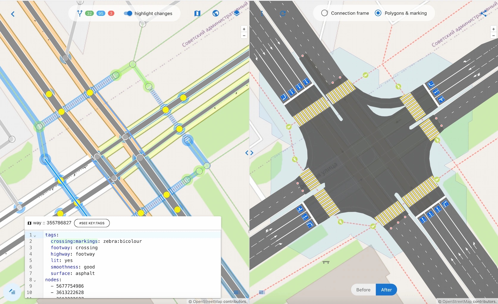 According to OSMPIE (OpenStreetMap Perfect Intersection Editor), "Mapping intersections and roads is a task for the brave." This tends to be true. OSMPIE tries to help this process be less painful. It takes some getting used to, relative to other OSM editing tools, but it's side-by-side schematic and render make certain aspects of intersection editing much easier to visualize.
OSMCHA: Inspecting and Reverting OpenStreetMap Changesets
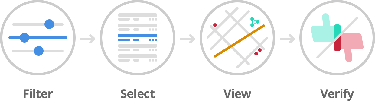 OSMCHA (OpenStreetMap Changeset Analyzer), is, according to the OSM Wiki a "web tool to help mappers analyze and review data changes to OSM. The objective of the tool is to help detect vandalism and act on bad changes to the map data." This can be very helpful when well-meaning but meddlesome individuals edit an area of the map without understanding other edits being made by the community. In the rare occurrence of needing to revert a changeset, the osm-revert tool is the way to do it. Use osm-revert only when strictly necessary.
Open GPX Tracker (iOS): Collecting GPS data for OpenStreetMap
![]() Open GPX Tracker, is, according to the OSM Wiki, a "GPS logger for iOS (iPhone, iPad, iPod). Track your location, add waypoints and send your logs by email as GPX files. This app has no annoying time restrictions, no ads and no in-app-purchases. Create unlimited GPX traces." It is useful for personal activity tracking, but, in the context of mapping, it's most useful for establishing a GPS "ground truth" of where new or recently changed features appear on earth. If curious, read more about using GPS data in mapping and how those types of data are specifically useful for contributing to OpenStreetMap. OSM users can upload and view their GPS tracks with varying levels of anonymity, and public GPS traces become available to the whole community to use for alignment and editing.
Open GPX Tracker, is, according to the OSM Wiki, a "GPS logger for iOS (iPhone, iPad, iPod). Track your location, add waypoints and send your logs by email as GPX files. This app has no annoying time restrictions, no ads and no in-app-purchases. Create unlimited GPX traces." It is useful for personal activity tracking, but, in the context of mapping, it's most useful for establishing a GPS "ground truth" of where new or recently changed features appear on earth. If curious, read more about using GPS data in mapping and how those types of data are specifically useful for contributing to OpenStreetMap. OSM users can upload and view their GPS tracks with varying levels of anonymity, and public GPS traces become available to the whole community to use for alignment and editing.
Note: when using Open GPX Tracker to collect data for OpenStreetMap, it is ABSOLUTELY NECESSARY to select "Activity Type" of "Flight: Airborne Activity", as this will store raw GPS data. All other activity types will attempt to snap GPS coordinates to existing OSM features, rendering the GPS trace useless to the OSM community.
MyLand: Abu Dhabi Department of Municipalities and Transport
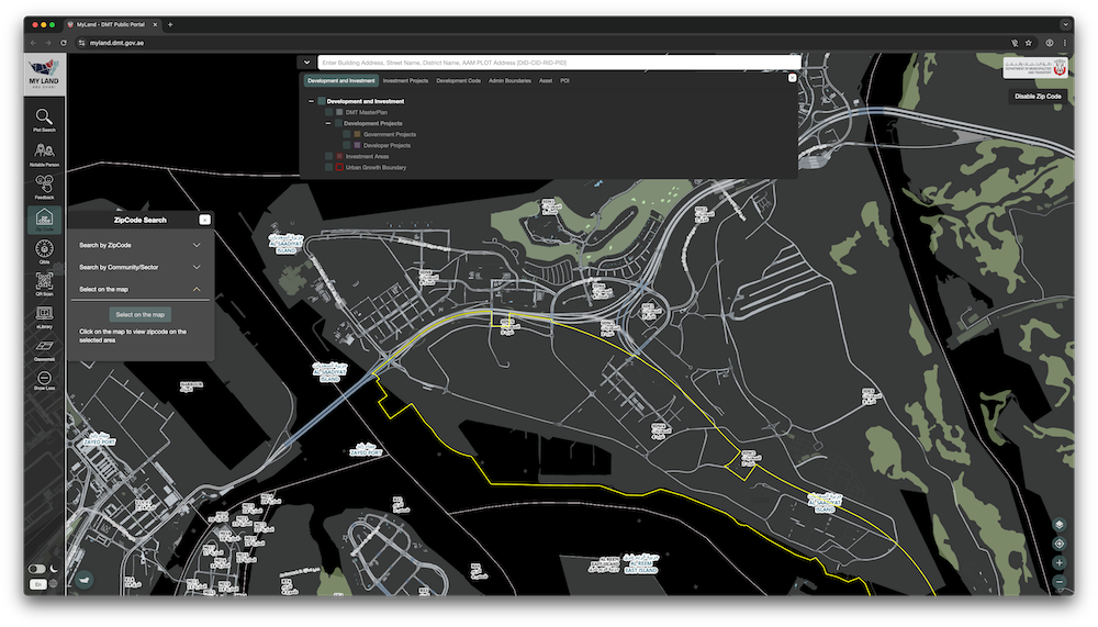 MyLand is a map of the UAE with many GIS layers available. It is also an excellent source of road names and planned land use in the UAE. There is also a "Map Service" version of MyLand with relatively up-to-the-minute nadir imagery; though, you can also access this imagery from the main link, too, and it tends to be from Google or ESRI.
Overpass Turbo: Data mining tool for OpenStreetMap
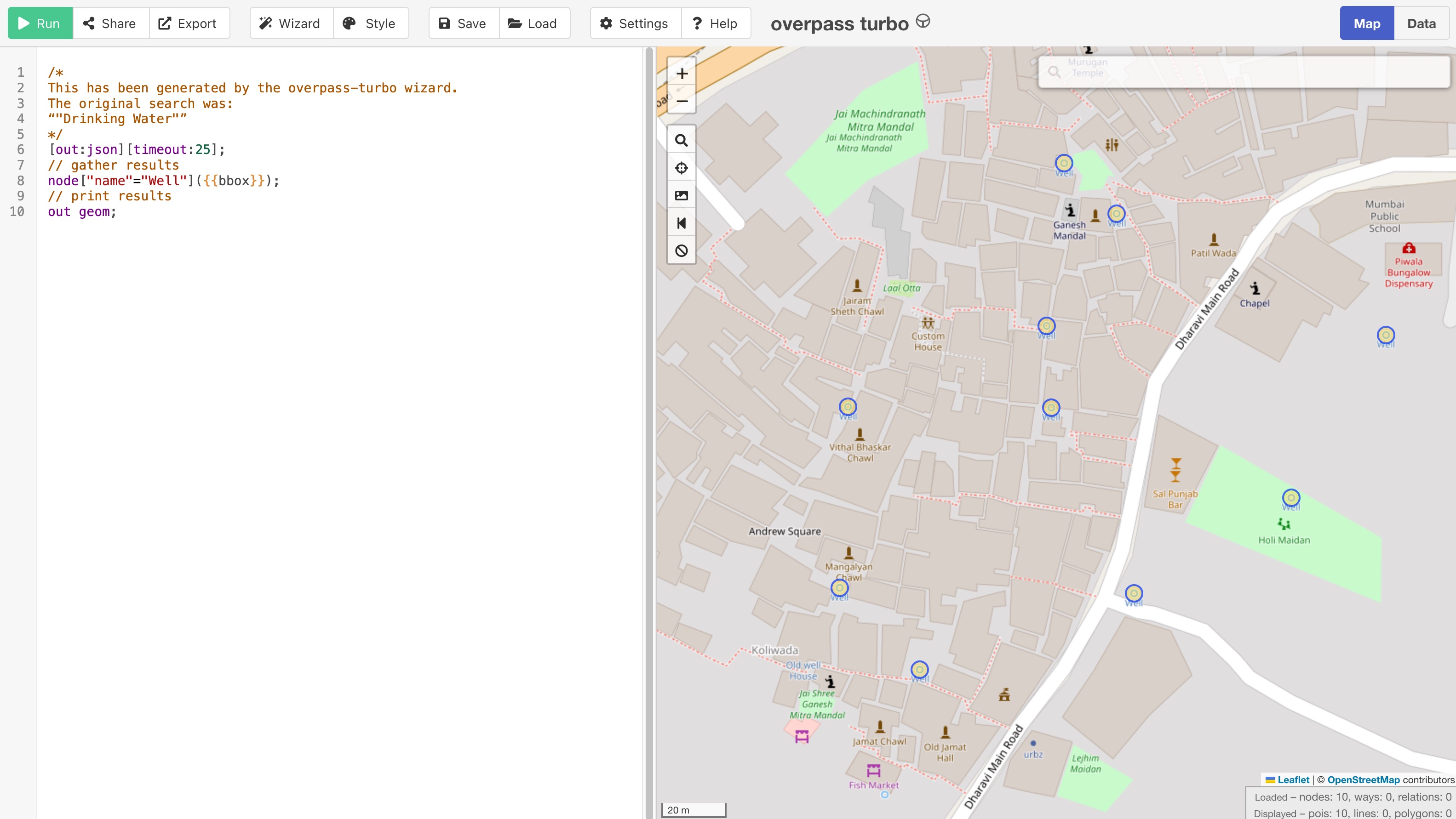 Overpass Turbo is, according to the OSM Wiki, "a web based data mining tool for OpenStreetMap. It runs any kind of Overpass API query and shows the results on an interactive map. Using it can get technical quite quickly: beginners may find the "wizard" a good place to start."
OpenLevelUp: Viewing Indoor Maps
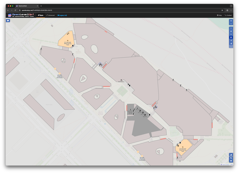 OpenLevelUp is a beautiful way to view indoor mapping data. Indoor= is another viewer, but it tends to be a little over-simplified. Indoor mapping is still quite a niche use of OpenStreetMap, and it can create a gnarly and hard to decipher map for casual mappers wanting to contribute. It can, however, be justified, in cases of mapping malls, transportation hubs, universities, and other publicly-accessible buildings or campuses with vast numbers of named or addressed internal spaces like shops, offices, and auditoriums.
OSMinEdit: Indoor Mapping
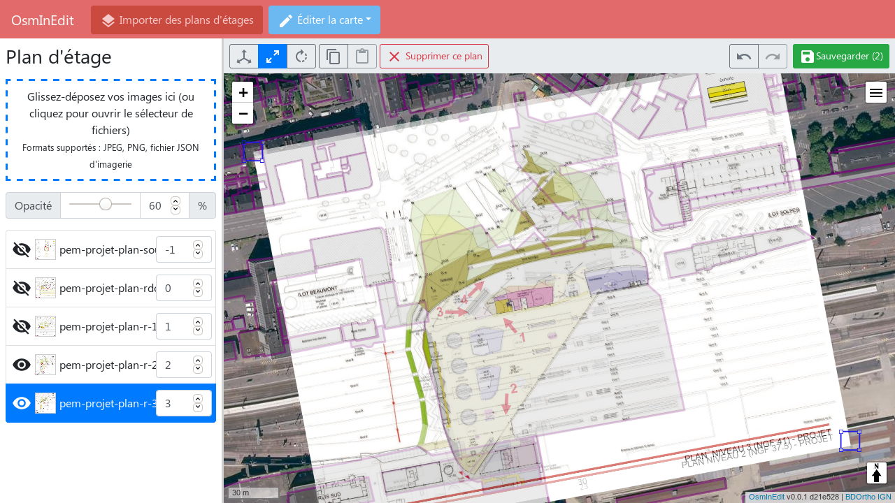 OSMinEdit is, according to the OSM Wiki, "OsmInEdit is intended to be simple as iD editor, and focused on mapping what's inside buildings. OsmInEdit offers indoor-dedicated functionalities." Indoor mapping is still quite a niche use of OpenStreetMap, and it can create a gnarly and hard to decipher map for casual mappers wanting to contribute. It can, however, be justified, in cases of mapping malls, transportation hubs, universities, and other publicly-accessible buildings or campuses with vast numbers of named or addressed internal spaces like shops, offices, and auditoriums.
OpenStreetMap opening_hours Evaluation Tool
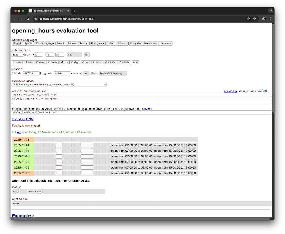 opening_hours Evaluation Tool - "The opening_hours tag is used in OpenStreetMap to describe time ranges when a facility (for example, a café) is open. This library exists to easily extract useful information (e.g. whether a facility is open at a specific time, next time it's going to open/close, or a readable set of working hours) from the complex syntax."
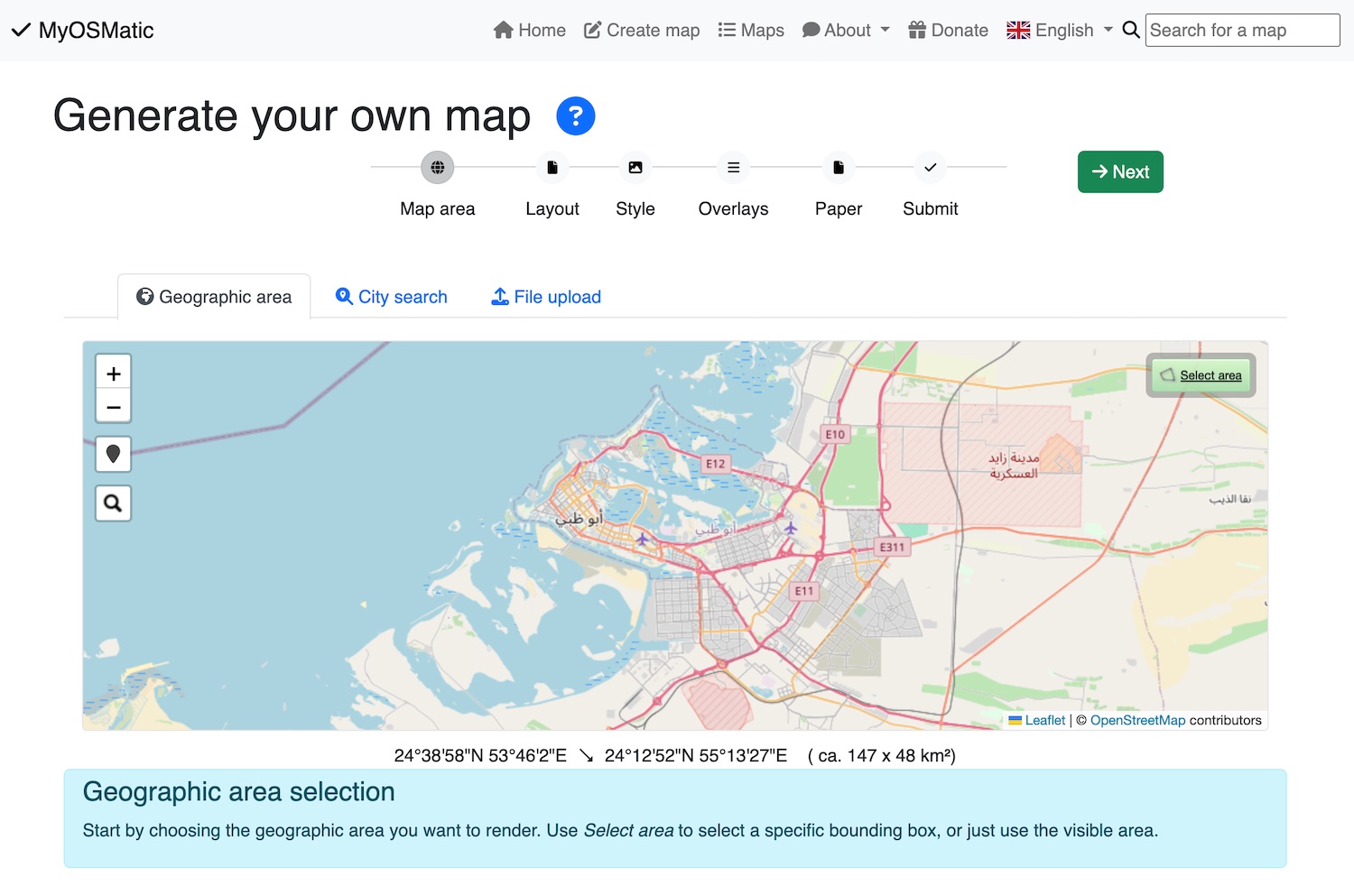 The OSM on Paper page on the OpenStreetMap wiki shares an evergreen list of resources that help produce maps that look nice when printed. The best and most flexible generator is MapOSMatic (on get-map.org); it even allows to import and overlay GPX tracks for making prints of treks, journeys, or trips. (Note: the original MapOSMatic webpage is often not working as well as the version on get-map.org). Others have suggested all-in-one tools like MapToPoster and City Roads, but they are typically more rigid in producing pre-formatted posters rather than generating high-resolution, print-ready files. There are other fun reasons to print maps; in particular, surveying can be done using Field Papers.
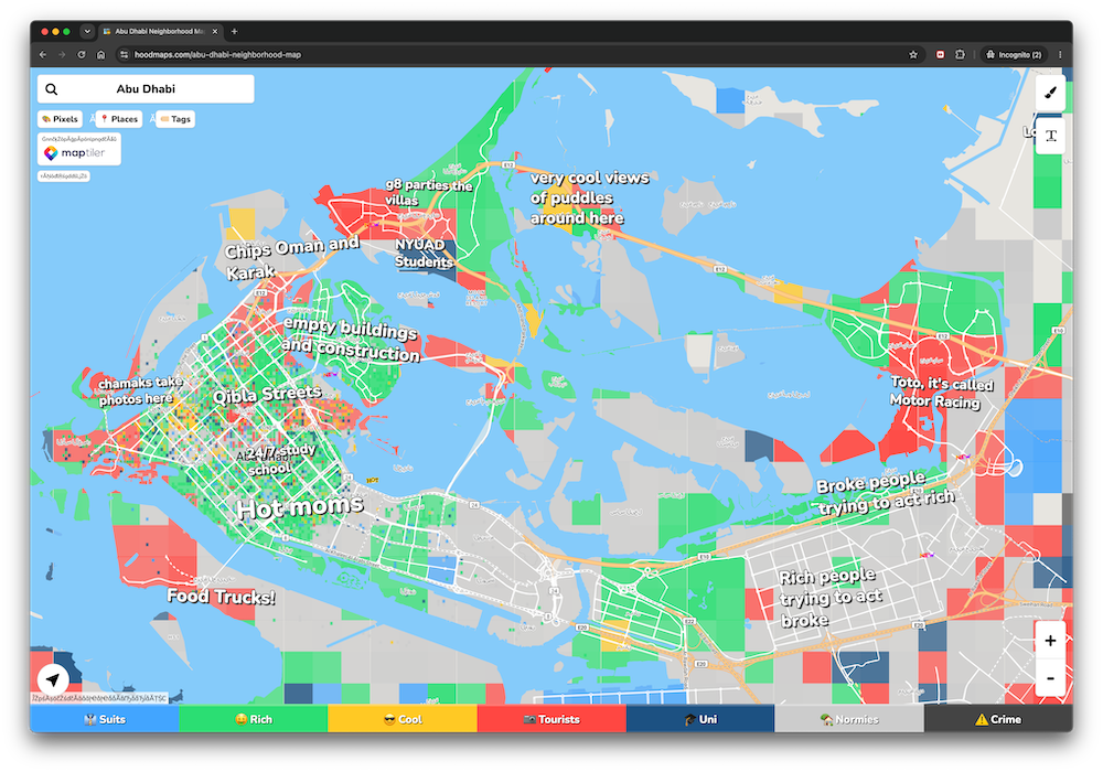 "hoodmaps" is a community-generated collection of neighborhood maps with "honest" labels for areas of cities. It's more of a fun thing than a source of well-structured data for use elsewhere. Take the labels with a grain of salt; it's mainly for entertainment, so don't get too emotional if you feel your favorite place is "slandered" by this data. Remember: you, too, can edit the map, but be warned that if you start putting labels that glorify the polished, marketing-speak, astro-turfed descriptions of a place, they'll likely be voted down by others who have more "real" thoughts and "hot takes" about places.
"Stereotypes are the mind's shorthand for dealing with complexities." — Robert E. Lane

حقوق الطبع والنشر © 2026 المؤلفين الأصلي. كل الحقوق محفوظة.